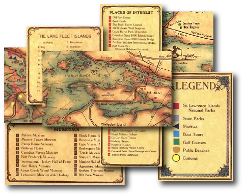
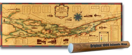
Antique‑Style 1000 Islands Map
Rich in detail and beautifully crafted, it’s designed to be both informative and visually striking. This high‑quality print is ideal for framing as wall art, displaying in a cottage, office, or living space, or even sealing under a bar‑top or tabletop to create a unique, conversation‑starting feature piece.
Unit Price:
$19.99
“We framed it and stuck it by the couch at the cottage. People always wander over and start pointing at islands they know.”
Lauren McBride
Clayton, NY, USA
“We hung it in our bar room and it instantly it was a hit amounge our friends. They start talking about summers on the river and bringing back great memorys
Mark Ellwood
Watertown, NY, USA
“It’s amazing how often this map starts a conversation. Someone points to an island, someone else shares a memory — it brings a quiet elegance to the room.”
Nora Caldwell
Kingston, ON, Canada